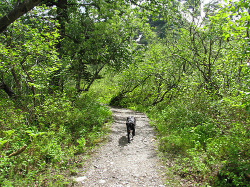
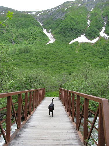
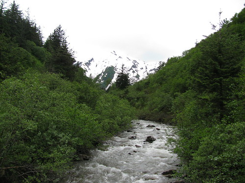
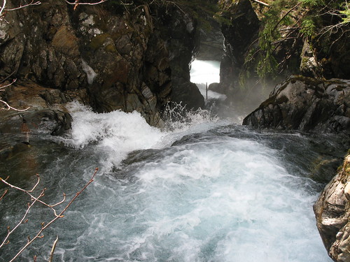
Showing posts with label trail. Show all posts

Monday, February 18, 2013

Bryce Canyon


Today was one of the shortest drive days at 3.5 hours.  We were in Bryce Canyon around noon, and after lunch, spent the afternoon checking out the park.  The park hasn't really changed much since I was there few years ago, and there wasn't really enough snow to make the scenery any different.  Still, it was a nice break from the driving.  As for walking Millie, we couldn't really do any of the hikes since they don't allow dogs on most of the trails, which are snow or ice covered anyways.  On the way into the park though, about 14 miles out, there is the Thunder Mountain trail.  The trailhead is at the first scenic view point as you head towards the park.  We only walked around for an hour, but since there wasn't anyone around, we were able to let Millie run around off-leash.  Actually, I think the area outside of the park was a lot nicer than the park itself.  If you're going to go into the park, you really want to spend time doing some of the hikes down into the canyon.


One of the things I noticed today, a bright sunny day, is that my eyes are now more sensitive to light than it used to be after living in a dark place for two years.  I find myself wearing sunglasses a lot more than I used to.

Sunday, June 10, 2012

West Glacier Trail

West Glacier Trail
Looking down on Mendenhall Glacier from top of West Glacier Trail

Brad and I did the West Glacier hike again yesterday and found it a bit more difficult than when we did it last year.  The trail itself is considered a difficult hike, gaining 1300 feet over 3.4 miles.  This year, though, there were several downed trees you had to navigate around, and the trails were more muddy and slippery due to all of the rain we've been getting this year.  There was also bit of water crossing that I don't remember doing last year.  The view up top is wonderful and worth the hike, but it's not one I'd casually do on a regular basis. 

The Spring in Juneau this year has been unusually wet and cold.  The temperatures have been hovering in the mid-50's mostly, with rain almost every day.  This means there aren't as many flowers in bloom, trails are extremely muddy, and snow from the winter are taking longer to melt.  It's a bit of a disappointment since we were looking forward to a nice summer, but what can you do?  I hope that we will get an unusually dry fall to make up for it, though I'm not counting on it.

Sunday, April 15, 2012

Hike from Hell to Eagle Glacier

Eagle Glacier
Eagle Glacier


I don't even know how to begin explaining our experience on the Eagle Glacier Trail. I wouldn't say it was horrible, though Brad may disagree. I was disappointed in some ways since the trip didn't quite turn out as expected. Yet, I was glad to have done it.

Eagle Glacier Trail
Start of the hike
The hike started off easy enough. I was a bit worried about the weight of my pack since I was not used to hiking with one. However, that did not seem to be an issue and my legs handled it fine.  We had also scouted the first couple miles of the trail a few weeks back and knew we wouldn't have much issues with at least that part of the trail. There was lots of snow on the ground still though, and I worried about what the conditions may hold for us later in the trail. We started on a pretty slow pace, stopping for photos and shouting for bears.  We left just before 1pm and expected to get there around 5ish. Well, it turned out that we only covered about 3 miles in that time and still had another 2.5 miles left to our cabin at Eagle Glacier. The snow and ice on the trail slowed us considerably, and there were other obstacles such as dodgy bridges, flooded trails, and fallen trees. The trail by everyone's standards is rated "difficult". There's no total elevation gain, but there is enough ups and downs to give you a good work out.

Eagle Glacier Trail
Brad falling thigh deep into snow
The last two miles of the hike to the cabin was absolute hell.  We'd walk for a long time and get very discouraged when we look at the GPS and saw we only covered a third of a mile. Friday the 13th indeed. There was more snow cover here and the recent warm weather made it soft.  We both kept falling knee and thigh deep into the snow. Snowshoes would have been really helpful for this part. Brad had it even worse, since he weighed a lot more than me and didn't have poles or cleats. I was a bit frustrated since I did warn him against taking unnecessary gear and encouraged him to take poles and cleats. However, I was also very concerned since he was really hurting. It is easy to twist an ankle or hurt your knees in these conditions. He had the additional danger of slipping on ice. I knew I could continue on, but he and I were unsure whether he could. What if he really did injure himself and physically couldn't go on? We joked at the possibility that we could end up on the show "I Shouldn't Be Alive." He pushed through his pain and kept going though. 

We eventually reached the cabin at about 8pm, seven hours after we started. The hike was not the most strenuous one I've done, but it was probably the most difficult. At the cabin we got a glimpse of the Eagle Glacier (above) just before the sun went down. At night the sky was clear and the stars were magnificient. I was hoping to see the aurora borealis but wasn't quite so lucky.

Eagle Glacier Cabin
Eagle Glacier Cabin
Our original plan for our second day was to hike two miles to the Eagle Glacier and back. Well, after yesterday's ordeal, we knew it would be difficult getting there in these conditions. Plus, we needed to rest up our legs for the trek back the next day. I also wanted to see this waterfall that was supposedly only a quarter of a mile past the cabin. We couldn't find the trail to it though amongst all of the snow. So instead, we relaxed at the cabin and enjoyed the peace and quiet. No one showed up at the cabin that day, not that we expected anyone would be crazy enough to come out here and go back on a day hike. The only wildlife I saw were squirrels, but Brad claims he saw a wolf in the evening while outside peeing. Despite not being able to do what I wanted to do this day, I actually enjoyed just being at the cabin. I liked being there so much I'm considering booking another cabin somewhere. In a way I want to come to this same cabin again, but in the summer.

The next day we set off quite early at 0630. We had to get to Pet Nanny's by 3pm to pick-up Millie. We worried it might take us longer to get back with our tired legs, but we did a little better coming back. We were back by noon. It was a little easier to get back because we hit the hardest part of the trail first whilst we had the strength. Plus, we were able to trace back our footsteps (or holes) and avoided falling into the snow as much. Brad had also shed about 30lbs of food and water, which helped a lot. It was a tiring hike back but our spirits were much higher than the hike in. After about 3-miles walking, we ran into three women who were planning to hike out to the cabin in back in one day. One woman was unsure if they'd actually make it all the way out there, but the woman with a f'ing cup of coffee in her hand made it sound like this was a stroll in the park for her. There's a lot of fit people in Juneau who probably do these types of hikes all the time... but hiking with a cup of coffee?  I really would like to know if she made it there and back on that particular day.

Wednesday, September 28, 2011

Porcupines


My poor Millie has been stung by Porcupines twice :(  First time it happenned, I was near the end of Perseverence Trail and she came out of playing in the bush with two quills.  She wouldn't let me near her to get it out, so I gave up and hiked 3 miles back with needles stuck in her nose.  Once home, I had my husband pin her down and I managed to pull them out.  I was not there the second time.  My husband was couple miles up Salmon Creek Trail when she got stung.  She didn't learn from the first instance.  This time, she was practically crippled with 12 quills stuck in her paws.  She was lying on her side, probably from pain, and could not move.  Brad had to carry all 62 lbs of her down the trail and rushed her to the vet.  They had to sedate her to ease her pain while pulling them out.  She was quite loopy afterwards and took couple of days before she was moving around like her old self.  I was away on a business trip during that time and was really sad I could not look after my baby.  For future reference though, here is what my husband says about how to pull out porcupine quills:

Let's start out with some facts and fiction...
FICTION:
1.) Porcupine Quills contain Poison. False! The American Porcupine does not. The Indian Porcupine does. Guess which country the Indian Porcupine comes from?
2.) Porcupines shoot Quills at enemies in Projectile fashion. False! They wave their tail and back when in distress and must physically touch an enemy for the Quill to stick in it. Likewise, if a dog touches a Porcupine, the Quill will stick in it. Quills do not "shoot out".
3.) Porcupine Quills are pressurized and must be snipped at the end before they are pulled out. False! This is utter bullshit. They are very slightly barbed, but not pressurized by any means.
FACT:
1.) Getting a Quill in you is very painful. True. Even one hurts like hell. Like a little dagger sticking into your skin.
2.) If your dog looks like she is in pain, take her to the Vet. Don't try to remove Quills yourself unless there is only 3 or 4 of them. Your dog may need sedating to kill the pain.
3.) If your dog has less than 5 Quills, you can avoid Vet fees by trying to remove them yourself. Read below for directions.
REMOVING QUILLS YOURSELF, WITHOUT A VET... (if there is more than 5, see a bloody vet!)
You will need:
1.) a strong grip.
2.) disinfectant (hydrogen peroxide etc)
3.) a set of balls
4.) a second person would help to keep Millie still.
First, have your disinfectant handy.
Now grip the quill as far down as you can, closest to the skin of the dog for best grip. What you want to do is very slightly turn the Quill at a very slight angle as you pull it. Don't pull it straight. The barb is not very big, but to avoid excess damage to Millie, pull it out quickly at a slight angle. As soon as the Quill is out, place it away to one side and do the next one.
Once all of them are out, dab the affected areas with disinfectant on a tissue to stop infection
That's it! All done. She'll be hurting for the rest of the day. Just let her rest.
-----
Hope this helped.

Monday, September 12, 2011

Granite Creek Trail

If it feels like it's been a while since I've posted, it's because it's been a while since I've done anything worth blogging about.  Since early May, it has been raining practically non-stop.  I knew it was coming, but I didn't realize it would be so soon.  I was quite disappointed at how short the summer was, and I expected to not see sun again until March.  I started off being quite bummed about the weather, but I decided to try to deal with it by looking for new ways to entertain myself besides hiking.  I joined the gym at work, went swimming couple times at the city pool, and let my husband talk me into going halves on an Xbox.  Just as I had finally found ways to cope with the bad weather here, I get a weekend full of blue skies.  I spent the Saturday checking the Eagle Crest Ski area and found that to be a great place to hike also.  I didn't hike all the way to the top though because I knew I had a long hike the next day on Granite Creek Trail.  I had heard it was a nice trail, but I didn't realize what an understatement that was.  It was an absolutely gorgeous hike.

Granite Creek Trail

The trailhead to 3.5 mile Granite Creek begins about 2 miles into Perseverence Trail.  Once turning onto the trail, you go up some narrow switch backs until you get to a snow bridge (pile of unmelted snow over the creek).  The trail from here gets a bit muddy in places, like most Juneau trails, but it's not too long before you gain elevation and start getting some nice views of the mountains.  Your first wow factor comes at the large water fall.  After admiring the falls a bit, you continue on until you reach what looks like your destination - an open view of lakes, creeks, and mountains.  Then you realize you've only travelled about a mile in so you know you're not there yet and keep going.  However, the view is just so amazing I kept taking photos. 

Granite Creek Trail

A little more ways in, I turn around and am amazed at the view again.  We stopped for lunch, but had to keep going afterwards since we weren't at the end.  We weren't quite sure how far to go, but we saw another big waterfall ahead and went closer.  There was a steep trail that went up to the top of the falls, and once there, it was just wow again.  Maybe because we just had so much rainfall, there were waterfalls everywhere and a large stream flowing.  I would rank this hike up there with those I've done in Banff, New Zealand, or Nepal.  I don't think my pictures do it much justice, but I thought it was just beautiful. 

Granite Creek Trail

I think we reached about 2300 feet (from 83 feet at start of Perseverence Trail), but we still had maybe a mile to go and another 200 feet to climb.  Unforunately, we spent too much time enjoying the scenery and had to turn around because my friend had to get back by a certain time.  I'm not sure what's up there at the end, but I'm looking forward to finding out next time I go.  I'd also like to try to get out there a bit earlier to see more wild flowers.

For those of you who are quite fit, there is an option to hike up Mount Juneau (trail up also starts from Perseverence), hike along the ridge, and come down the Granite Creek basin to the trail.  I bet that would be an awesome hike.

Sunday, August 7, 2011

Dan Moller Trail

Dan Moller Trail

Today Matt and I did a 3-mile (one way) hike with 1600 ft elevation gain.  It's an out and back through Muskeg meadows to the Dan Moller Cabin and back.  The hike is quite easy despite the elevation gain since it is a steady gain over the 3 miles.  The entire trail is also planked since the meadows are quite muddy with soft footing.  The planks can get slippery though, so becareful and watch your footing while you walk.  If you're dog loves water like mine, there are also many mud pits that she can jump in.  Your dog will definitely require cleansing afterwards.

At the end of the trail is one of Forest Service's newer cabins.  It sleeps 4-8 on the second floor and 2-3 people on the bottom floor.  (Requires reservation - $35/night.)  There is a furnace, wood stove, and an outdoor fire pit for heating options.  There is also an outhouse, although it was near full today... eww.  The cabin has great views of the mountains all around.  There's not a whole lot else up there, but if you felt adventurous, there is probably a way up to some of the surrounding ridges. 

Dan Moller Trail

Sunday, July 17, 2011

Hike to Gastineau Peak (3672ft)

Hike to Gastineau Peak

Today's hike to Gastineau Peak was probably the hardest I've done since hiking in Switzerland back in '07.  It's also about three times higher than the highest I've done in Juneau.  The trail started on Basin Road at an elevation of about 300 ft.  The first hour and half of the trail is actually quite boring.  It's a steady hike up a muddy trail through the rainforest.  If I didn't have Millie with me, I could've avoided it by taking the Mt. Roberts Tram up from downtown to about 1800 ft.   That would've made my hike a lot easier.  There are couple of view points along the trail to the tram, but none are worth stopping for if you plan to hike past the tram stop. 

Hike to Gastineau PeakOnce at the tram station, I stopped there only to let Millie have a drink at the water bowl they keep out for dogs.  The trail below had only a few places for her to get a drink, and it was a pretty warm day out for Juneau.  After the brief stop for water and a view, we continued on up the trail.  You get a view of Gastineau Channel most of the way up, and the view just gets better and better as you get higher.  The terrain also changes from rainforest to sub-alpine, and many wildflowers are in bloom.  The trail seems to be a widely used one, by locals and tourists.  The few we saw going up that morning were locals.  It was comforting knowing others were and will be on the trail since it was just me and Millie today.

Hike to Gastineau PeakA bit further up the trail we started seeing piles of snow leftover from the winter.  Good thing because that was Millie's water source.  She would either eat the snow or drink from the stream or puddle made from melting snow.  She also liked to roll around in it to cool off.

Hike to Gastineau Peak

The climb was long and a little difficult since it involved narrow and rocky terrain in places.  It wasn't as muddy as the trail below the tram though.  There were also walks through thick vegetation and I worried that a bear might be around the corner where I couldn't see.  I jingled my bear bell occasionally & luckily I didn't see one.  I got to a place that looked like it could be Gastineau Peak, but I was disappointed to find out it was only the Gold Ridge.

Hike to Gastineau Peak
The dreaded ridge
There was little more ways to go before hitting Gastineau Peak, but that little way required crossing what looked like to me as a trecherous snow covered knife edge ridge crossing.  I couldn't really see what would be on the otherside a little ways and I wasn't entirely sure if it was good idea to cross with only my sturdy hiking boots and an unpredictable puppy.  After consulting another hiker that came up behind me I decided I might as well give it a shot since it was just a little more ways to go to the top.  I tried to keep my eyes focused on the ground while crossing it though since I felt a bit of vertigo coming on looking down the sides.

Once at the peak, which my GPS said was 3672 feet, I had my lunch and got a few snaps.  I could see the trail that continues on to the peak of Mount Roberts.  It was only supposed to be another mile and 200 feet elevation gain (maybe a bit more in actual since you had to go down first to go up the peak).  Perhaps it was another 45 min or so to get there, according to another woman who was on Gastineau Peak with me.  I didn't plan on going all the way today, and decided to stick with my plan because I still had to get down and I wasn't sure how I'd fare.  I felt fine at the moment, but I figured I'd save that for another time. 

Hike to Gastineau PeakI always take it slow going down.  Given the steepness and rockiness of trail in places, I wished I had a stick or poles.  It's tough on your knees without them.  Then again, it didn't seem to do another hiker much good.  On the way down I ran into the guy who had convinced me to go across the dreaded ridge.  He had slipped and broken his leg!!  There were many other people already there attending to him.  They had put a splinter on his leg with his hiking poles, and called the tram station to get a gurney sent up for him.  After making sure my help wasn't needed, I kept on heading down.  I passed a medic on the way up, followed slowly by 2 not-so-fit looking guys struggling to get a wheeled gurney up top.  I wondered to myself how the hell they are going to get that thing up, and then down, but I quietly hoped they were trained and knew what they were doing. 

My legs were getting quite tired and stiff, but there's not much to do but keep going.  Another stop for water at the tram and we continued on down the lower half of the mountain.  Seemed like such a long way down.  It almost feels harder getting down than going up since your legs are tired.  It's a shame that going down isn't as enjoyable as going up. Regardless, we made it, and I'm glad to have done it since I had been looking forward to doing for so long.  It was a beautiful hike but I doubt I'll be doing that one again this year though.  There's plenty other difficult ones to try first.  Next year I'll shoot for Mount Roberts. 

Hike to Gastineau Peak
The trail continues on to Mount Roberts

Sunday, July 10, 2011

Eagles & Crow Point Trail

Bald Eagle

Alaska is a great place to see the Bald Eagles., the national bird and symbol of USA.  You can often see them flying around or perched on a tree top while on a hike.  If you want to see many eagles, or increase your chances of seeing one, then head out on the Boy Scout/Crow Point Trail.  You can reach the trailhead by turning left just before Herbert River, and then turning right at the end of that road.  About a mile walk on flat trails with Eagle River to the right, through the forest and meadow, will get you to a beach across the river from Eagle beach.  I suppose it might be easier to just go to Eagle beach, but I think you will see a lot more from the other side of the river. 

Boy Scout TrailI have seen countless Eagles on this trail, but there are also many other types of birds all over the beach.  Some are in flocks, and others are hanging out on their own as a one of a kind.  The trail also is a nice one to do even on a rainy or cloudy day.  It's an easy stroll through the rainforest, and once out by the meadow, you can also see berries and wildflowers.  You can also walk along the beach for perhaps another mile or so to the point. Unlike most beaches on mainland USA, there's a pretty good chance you will have this one all to yourself.

Salmon Creek Trail

Salmon Lake
Salmon Lake

Although there are many trails in Juneau, I'm somewhat of a fair weather hiker so it is taking me a little while to get around to some of the longer hikes.  Many of the hikes that actually gain any significant elevation are a bit difficult to do if it is wet because it can be steep and slippery.  I suppose I'm still in the mid-range hikes, looking at something about 6-7 miles in length with 1000-1500ft of elevation gain.  Today's hike was 3.5 (o/w) up Salmon Creek Trail to the Salmon Creek Lake and dam at 1100ft.

Power House on Salmon Creek Trail
Power house about 2 miles in
The trailhead is at mile 2.5 on your right off of Egan when coming from downtown.  The first couple miles of trail is pretty wide and easy (once you get past first little bit up hill).  You can see Salmon Creek off to the side in places, and a pond of sorts which is a good place to stop for the doggies.  The wide trail ends at a power house next to the creek, but you can continue off to the left side of the power house to head up to the Salmon Creek Dam.  The trail now takes you through the forest to the dam.  Once you get to a point where you can view the dam from below, you can continue up to the left a set of stairs and steeper trails.  The terrain gets a little challenging here, as the trails become narrow and more steep with some slippery places.  Millie got pushed off a trail by Charlie at one point and went sliding down hill about 7 feet.  Poor girl.  She managed to climb her way back up though. 

Salmon Creek Dam
The dam
Your efforts on this trail are rewarded at the top with a fantastic view of the dam and Salmon Lake.  Supposedly this is where Juneau's drinking water comes from so it's not a place you can hang out and go for a swim or anything.  There's a bench up there to sit on and enjoy the view though.  If you're lucky, you might see some mountain goats up there but we didn't see any.

Sunday, June 12, 2011

Perseverence Trail


The Perseverence Trail seems to be high on Juneau's list of recommended hikes.  I bet it would be one that is recommended at a vistor's center, and you can also find information on this trail if you search for Juneau hiking information online.  I've been wanting to see what this trail was all about for a while now.  I tried to hike it back in early May with some friends, but we ended up turning around after getting two-thirds of the way because of all of the snow.  I think we were also too busy trying to make our way through the thigh high snow to actually enjoy it.  Well, now that it's mid-June, the time seems to be right.

The trail head is at the end of basin road, about a mile or 2's walk from downtown up the hill.  The hike itself is not difficult so if you don't have a car you could make an all day trip of it.  If you start at the trailhead, the hike is about 6-7 miles round trip with about 700 feet of elevation gain.  Most of that elevation gain is at the beginning of the trail.  You walk mostly along a cliff edge and if you are with a dog, you might be slightly nervous if he/she gets near the edge.  Also, I wouldn't recommend this hike before early May when the trail is cleared of rock slides.  If a rock slide blocks your path and you try climbing over it, you could very well slide off the trail to your death.  Don't worry in the summer though.  The trail is plenty wide so unless you're walking on the edge of the trail, you should be fine.

The trail becomes more safer and more beautiful after about three quarters of a mile in.  You are no longer near the cliff edge, and the scenery becomes more green with vegetation.  Since it rains a lot in Juneau, it's all very lush.  Add some wildflowers, a few butterflies fluttering about, and birds chirping in the background, and you almost imagine this must be what heaven is like.  Or perhaps someone's garden.  Only when you look in the distance and see the snow capped mountain do you remember that you are in the wilderness of Alaska.

It's possible to see bears, and perhaps other wild animals.  I did not see any, but Millie had a close encounter with a porcupine.  She got so close that she got stung by one of its needles.  I did not see this, but after some moments of playing in the bushes, she came out with a needle stuck in her nose.  I think she was a bit excited or scared because she wouldn't let me near her.  These needles are hard to pull out even when she is still, but nearly impossible when she's not.  Since this happenned just as we turned around at the end, she had to walk all 3 miles back with the needle stuck on her.  One trick I learned today from various passerby's is that if you cut the end of it off, it will let the air out of the needle and make it easier to take out.  Once home, I had to get Brad to hold her firm while I snipped the needle and pulled it out.  I think she bled a little from it, but was otherwise alright.  This is actually her second time being stung by a porcupine so I hope now she has learned her lesson.

Looking down top of a
waterfall (requires side hike)
Aside from the porcupine incident, the hike was very nice.  The end of the trail was a little anti-climatic though, since it ended at a pile of landslide.  The trail itself is in the valley between Mt Juneau and Mt Roberts, so there are also parts where sun doesn't shine as much.  We found an area towards the end where there was a pile of snow. 

In addition to the main trail, there's a few shoot offs.  About a mile into the trail is the trailhead up to Mt Juneau.  There's also the Red Mill trail that serves as an alternate route for part of the way.  Near the end of the trail is another short trail to the Mining Camp.  Since I was a bit concerned about Millie's well-being with the needle stuck in her nose, I ended up just taking the most direct route back.  I'll have to do this trail again so I can check some of these other routes.

Saturday, June 11, 2011

East & West Glacier Trails

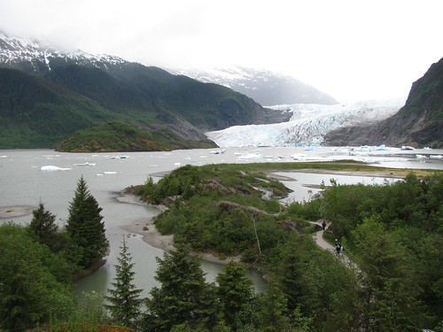
View of Mendenhall Glacier from behind the Visitor's Center

There are several hiking trails near the Mendenhall Glacier.  Last week we did the East Glacier Trail and today we did the West Glacier Trail.  Both are really nice trails worth doing.

The East Glacier Trail starts behind the visitors center and starts on the Trail of Times.  It's about a 3.5 mile loop trail, with moderate elevation gain.  The trail is mostly in the forest, but there are occasional clearings to give you a glimpse of the glacier from higher up.  A small waterfall, the AJ waterfall, is also a short walk from the trail.

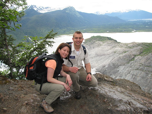
The West Glacier Trail starts at the end of the road just past the campground.  This is about 3.5 miles one way (7 miles r/t) with 1500 feet elevation gain.  The trail is through forest also, with some creeks and small waterfalls along the way.  There are many viewing spots along the way, and the views get better and better as you get higher up.  Toward the end of the trail there's quite a bit of rock scrambling though, and it can be a bit of a challenge.  We had couple of pups with us that kept wrestling with each other the whole way up.  There were several times they got close to the edge of a steep drop off and had me a bit nervous.  You really don't want your dogs to be playing tug of war with a stick on these rocks.... 

Once at the top there's a rock outcrop with a fantastic view of the Juneau icefields - definitely worth the hike.  From there, you can see people trekking on the icefields.  We also saw a few helicopters who touched down on the glacier for about 20 minutes while their passengers walked around a bit.  They probably paid few hundred bucks for their tour.  Our hike was free.  There was also a yellow igloo like structure towards the left hand side of the icefield.  That may have been the dog camp where people can go dog sledding as part of a tour. 
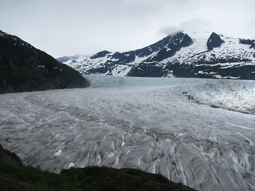
The rock outcrop made for a great place to have lunch.  It's definitely the best view of the glaciers I've had so far here.  Unfortunately, the sky looked a bit ominous and we decided to turn around to avoid rock scrambling in the rain.  I think if we kept going a bit further though, we could actually touch the glacier.  It's not really wise to go near the face of a glacier since it could break off, but it would be cool to get a bit closer.  Perhaps next time.  Even as it stands though, this ranks high up there on my favorite hikes in Juneau.

View of Juneau Icefields from the West Glacier Trail

Sunday, May 15, 2011

Point Bridget State Park


I'm not sure how true it is, but I heard from a friend that the cruise ship passengers get 10-12 hours in Juneau on their tour of Alaska's Inside Passage (South East Alaska).  There's no way anyone can appreciate the full beauty that Juneau offers in that time.  If you're encouraged to do the typical touris thing, you'll probably end up walking around downtown, catch the tour bus to Mendenhall Glacier, and take the tram ride up Mount Roberts.  You probably don't even hear of places like Point Bridget State Park, which is amazing, because I didn't even know anything about it until I went this weekend. 

The trailhead begins at Mile 39 on Glacier Hwy (aka Egan Drive).  It's about a 3 mile trek through rainforests and meadows to the point closest to the water.  On the way we saw a cute cabin that is available for public use (must reserve).  It'd almost be a great place to stay if it weren't all the hikers that will pass by.  The views all around on the trail were quite fantastic but once at the end you had a panoramic view of the water and the mountains.  Combined with the awesome weather we had yesterday, it was just a gorgeous place to be on a gorgeous day.  We stopped a bit here to grab a bite to eat and just enjoy the view.  Using our binoculars, we could see orcas and sea lions out in the water. 

After a little break, we headed up another half mile to Blue Mussel Cabin.  Not as many people come all the way to the end, so it was a very peaceful place to be.  It was very tempting to just lay down across the picnic table for a nap after the long walk there. 

The trip out to Blue Mussel Cabin and back was 7 miles.  There is an option to loop around back to Glacier Hwy (but not back to the same parking lot), and there are some lakes along that route.  Perhaps next time I will try that route.  Oh, just a little warning about the trail - it's quite wet and muddy in many places.  You definitely need waterproof shoes that go above your ankle.  If you have ExtraTufs (Alaskan rainboots), even better.

Sunday, April 17, 2011

Windfall Lake Trail

Windfall Lake - still a bit iced over
Up to now, I've only done the short trails but I am now eager to do longer ones.  Unfortunately I don't have the right equipment to do any 'climbing' in early Spring conditions.  Even the low elevation ones can be icy and a bit difficult to traverse.  So another easy low elevation trail here is the Windfall Lake Trail.

The trailhead is at the end of a gravel road to the right of Egan just South of Herbert River.  My Corolla didn't have enough bottom clearance to go over the snow covered road in places so instead of chancing it, we left our car at the lot on the corner of Egan and the gravel road.  The walk to the trailhead there was about .5 miles, so that added about 15 minutes to our walk each way. 

I was a little disappointed the trail was entirely through the forest.  I had hoped for some clearing to get views of the peaks you get a glimpse of towards beginning of the trail.  The whole way is shaded though and you don't get a view until you get to the lake... and it's 3.5 miles to the lake from the trailhead.  The trail is again planked and icy.  It took us an hour longer to do the hike than expected.  We saw a family of four coming back from the lake though, with their bicycles.  It can't imagine walking that trail with a bike.  Or even riding on it.  Either they thought it sucked bad too or we are just wusses. 

Parts of the trail crosses rivers so there are several foot bridges along the way.  It's still icy at parts, and silly Millie fell in as she went on the ice to get closer to water.  I think she was a bit shocked too but she managed to swim and make her way towards us at which point we helped her out.  Once at the lake, we decided to keep her on the leash since we didn't want her falling through the thin ice over the lake. 

The last little bit of the trail splits into two and one path leads to a cabin maintained by the Forest Service.  The other supposedly goes to the lake but there is also lake access at the cabin.  It was our first visit to one of these hyped cabins.  For $35/night, you can rent one of these through recreation.gov.  This one was a pretty nice cabin.  There's a bunk in there where about 4 people can probably sleep (must bring own sleeping bags).  A table inside and outside, and a propane heater.  There's a solar powered outhouse outside the cabin.  There's no running water, but there's a canoe you can use to go out on the lake.

We didn't stay the night at the cabin, but it is available as a warming hut for the public during hours of 10-5.  We had our lunch on the outside deck and turned around.  I suppose it would be very nice though in the summer to just relax out there on the canoe, away from everything. 

Sunday, April 10, 2011

Lena Point Trail


The trailhead for this trail was tricky to find.  From Egan Drive, turn left towards the Lena Beach picnic area.  Maybe about a mile down, there is a sign facing the road (not down or up the road) that says "Lena Point Trail".  It's difficult to see ahead of time but you might notice it as you drive by.  If you end up at the turnoff to the radio tower or the NOAA building, both which will be on your right, you went too far.  There's a big empty parking lot used by the government right next to the trailhead. We parked by the trailhead because we weren't sure parking in the lot was allowed. 

The trail is mostly on planks through the woods.  Seems a lot of the trails here in Juneau have planks laid down.  This makes it a bit tricky because it can get slippery.  Or you could fall off it.  There is a slight (~230 ft) elevation gain on the trail, and once up top and out the woods, about a mile out, you get a fantastic view from Lena Point overlooking Lena Cove and the sea.  There's even a bench up there from which to enjoy the view. 

Most people go back the same way they came, but supposedly there's a shorter route back "along an undeveloped route, next to the fence, down to the parking area."  Btw, my husband thinks he saw a bear out near the trailhead.  I saw something too but am not sure what I saw.  It's that time when they all start coming out....

Sunday, April 3, 2011

Boy Scout/Crow Point Trails


To get to the trailhead, turn left from Egan just before the Herbert River and then turn right at the T.  It's only about a mile or so away from Egan.  The trail starts off in the woods, and there are still icy patches in the early Spring time.  I've come to realize that clamp ons or some sort of traction on your boots are really necessary if you want to enjoy some of these trails in Juneau before the summer.  Once out of the woods, you come out on the meadow and you see Eagle Beach across the river.  A little further down and you hit the beach.  There are multiple ways you can get to either Crow Point or the Boy Scout Camp.  We went to neither this time around because it was raining.  The walk along the beach is really nice though, since there was no one else out there.  It sounds like a popular trail though, so I reckon it's a bit more crowded when the weather is nice.  The book I have says the trail is a 1.5 miles one way, but it seemed like it was a little longer than that.  Bit hard to tell.  There's amost no elevation gain so should be doable in the winter if it's groomed.

Monday, March 28, 2011

Mendenhall River Trail


If you are looking for something a little longer than the two mile Airport Dike Trail, but something just as easy, this trail is it.  The trail, which is also known as Kaxdigoowu Heen Dei, starts at a parking lot off of Egan just across the Mendenhall River (coming from downtown).  It is a 4.2 mile out-and-back (2.1 mile one way) with the option to take the paved, hiking, or equestrian trail.  You probably will want a horse for the equestrian trail, and dogs are supposed to be leashed on the paved trail.  However, since the hiking trail is snow covered and some icy bits were hard to navigate due to the less gradual elevation changes, I stuck mostly to the paved trail (& let Millie off-leash anyways).  That's not to say that the paved trail isn't icy.  Unfortunately it is.  Your best bet is to get some clamp-ons of some sort to provide added traction.  I went without and managed, but probably it wouldn't be too enjoyable for some.  However, there were people biking and running on the trail, so it can't be all that bad.  Once all the snow melts though, it would be a nice trail.

Majority of the trail is in the woods, so on an especially sunny or hot day, it might be the cool way to get a walk in.  Part of the river is also accessible from the hiking trail, so a quick stop there for your doggy will make him or her very happy.  Because of the trees though, there isn't much of a view.  It's just an easy trail that's easily accessible and doable even in winter.

Airport Dike Trail


I mentioned this trail briefly in a previous post on dog-friendly walks in the winter.  However, I hadn't done the whole trail when I wrote that post because it was sooo friggin' cold when I went.  Now that I have done the whole trail, I realize I didn't really do it justice.  Going out, there are beautiful mountains across the wide open wetlands to your right and to your front.  The view is fantastic.  You can also go out into the wetlands but you have to watch out for the tides or else you could get stuck out there somewhere when the tides come in.

The trail is party gravel in places, and it can get a bit muddy while the snow is melting (doesn't seem to get too icy).  These days it has been mostly clear though.  The trail is only a mile and a bit long (so maybe 2~2.5 miles out and back) with no elevation gain, so it is great if you are looking for a quick stroll after work or something easy.  It seems to be a popular place for the locals though.  Many dogs running around - some on-leash, some off-leash.  I've been here a few times already when I need to exercise Millie and don't have much time for a longer walk.

Saturday, March 19, 2011

Rainforest Trails


Although you wouldn't think of rainforests in Alaska, it does rain in Juneau a lot so I suppose it is not surprising that you would find 'Rainforest Trail'.  There's actually couple of trails that go through the rainforest, both near each other close to end of the road in North Douglas.  One is the Outer Point loop trail, a 2 mile boardwalk loop.  The Rainforest Trail is a sprawl of intertwining trails, but a circuit is probably only about a mile.  Both provide beach access.  At high tide, the water comes gets very close to the forest.  At low tide, you can walk to a tiny island (Shaman Island) across the way.  I've seen people camp near the beach also.

The Outer Point loop provides a boardwalk for the trail users.  The new Rainfores Trail, however, has a turnpike that allows users to look around the surroundings instead of worrying about falling off the trail.  There is an article in the Juneau Empire that gives a little history about these trails: http://www.juneauempire.com/visit/hiking/outerpoint.shtml.

Sunday, March 13, 2011

Dog Friendly Winter Walks

As of the moment, my free time consists of getting settled in and trying to get Millie the exercise she needs.  During the week, this means taking her to the nearby Cope Park after work and let her run off-leash.  If I am lucky, there will also be another dog there and she will get a good romp around.  Occasionally, we're on our own and Millie just goes scavanging for food.  I did have a frisbee, but she wasn't very good at bringing it back.  I should try a tennis ball sometime. 

On the weekends, whether rain, snow, or shine, Millie must get a good long walk in.  There are many hiking trails all around Juneau, but all are snow or ice covered.  In just a few weeks time though, I found some nice places to take her for a good exercise.  They are not necessarily long walks, but since you can let her off-leash, she is able to run around and probably do at least 5x the length I am walking. 

Airport Dike Trail

This 1.2 (one-way) walk starts at the water treatment plant near the airport.  It's a well-groomed, flat walk along the water and through some trees.  The trail is actually part of the Mendenhall Wetlands State Game Refuge.  Probably a good place for bird watching in the summer. 
East Glacier Loop Trail

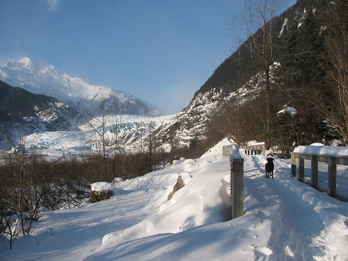
This trail will take you from the visitors center at the Mendenhall Glacier to a waterfall near the glacier.  Unfortunately it's not groomed so you only have the trails left behind by previous users.  Alternatively, you could ski or snowshoe it.  Dogs love romping around in the powder though.  It is also a short walk, perhaps .75 mile each way, but because of the deep snow, it takes a bit longer than expected to do.  At the end, you come to a clearing where you get a good view of the glacier and falls.  In the winter though, the falls seem to be only a trickle.  Perhaps most of it is frozen over. 
Mendenhall Glacier Recreation Area

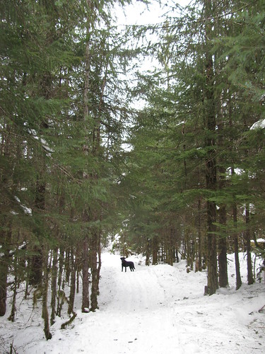
This is my favorite so far.  There are several trail heads off of back loop (back part of Mendenhall Loop Rd.) but I typically use the one at the Forest Service.  These trails are well groomed so you can walk on it easily.  Many people ski across them too.  What makes this trail unique is that it loops around various lakes in the area.  You can make your walk as short or as long as you like.  The terrain also varies a bit too.  In some areas you are on a narrow trail in the forest.  In other cases you are walking over a lake.  You can also get views of the surrounding mountains and glacier at different places.  These trails connect to the Mendenhall Glacier parking lots, so you could try different parts of the trails from different trailheads.  Although we had the trails mostly to ourselves, you do occasionally run into other doggies for a meet & greet party.

Sandy Beach

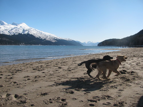
 This one probably wins the "most scenic" award.  It's really just a walk along the beach, but the view of the mountains on a sunny day is absolutely gorgeous.  Many owners bring their dogs here for a romp around, too.  So lots of tail-wagging and playing.  Us humans just have to walk a bit.  Walking from parking lot to the end is a nice length walk.  The only downside of being on the beach is your dog will get dirty so you have to give him/her a bath when you get back.