Today was our last day in Juneau. We were going to catch the midnight ferry and made plans to take Millie for a very long walk so that she would be pooped out for the day and a half ferry ride to Ketchikan. I had wanted to invite a friend or two to join us, but it was pissing rain in the morning so Brad & I decided to go just ourselves. This way we could stay flexible and turn back if the hike turned into a disaster - and a disaster it was.
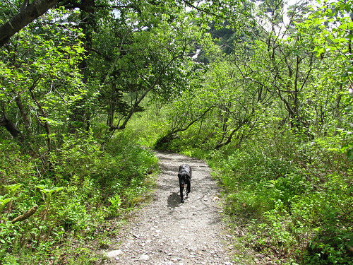
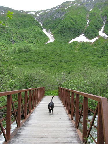
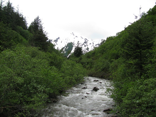
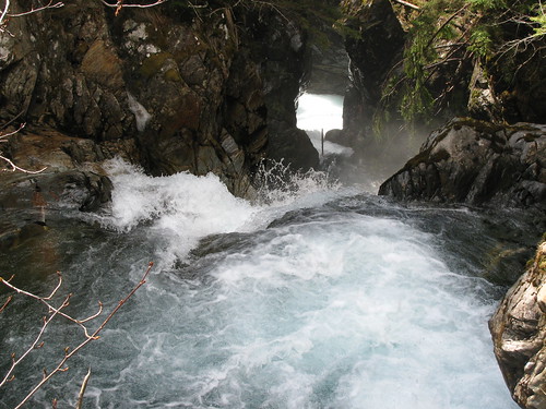
I'd been wanting to do Auke Nu trail for a while so I took us to that one. Neither of us had any idea what to expect on that trail, although I had heard it's a muddy one in summer. Since a lot of the snow at lower elevation has been melting, I thought it might be all muddy today, but it turned out ok - sort of. The first quarter mile was all ice, which we got by with grippy things on our shoes. The trail then turned to packed snow and was actually a pretty easy walk. The trail takes you through forest and muskeg, with the occasional stream crossings over bridges. The forest sheltered us from the rain and the views were nice. For a while I wished I did invite my friends along. After about 2 miles though, things took a turn for the worst. The trail got a bit steeper and put us higher up on the mountain where we were more exposed to the elements. It was chillier and windier, with rain turning to snow at times. The snow up here was also not as packed, maybe because there was less people using it, so we kept pot holing here and there. Our pace was slow going, and it seemed like it was taking forever to get to the next and final mile marker before the cabin. Well, if there was one, we never got to that mile marker. Brad was so fed up of hiking in those conditions by then that he wanted to turn around. I felt like we were so close the John Muir cabin that quitting now seemed like a shame. However, given that we had a ferry to catch that night, we couldn't really afford to do something stupid like get stranded at the cabin in a potential white out condition or get hurt. Seems every time I go on these long hikes with Brad it turns into some sort of a disaster. We joked about our Eagle Glacier hike we did last April, which was actually a lot worse, and how we're going to die here on the trail on our last day in Juneau. It wasn't as extreme as it sounds, but I suppose the potential for a real disaster was there. After I agreed to call quits we took shelter under a tree so we can scarf down some lunch and started the 3 mile descent back down. Once back, we got a good nap, a shower, and a dinner before heading to the ferry terminal.
Showing posts with label hiking. Show all posts
Showing posts with label hiking. Show all posts
Saturday, February 9, 2013


Sunday, August 26, 2012
Eagle Crest Hike

Perhaps I was a bit premature with the last post since we got another day of summer today. DeAnna and I went somewhere we haven't been yet - top of Eagle Crest. Although you can't find this information in the trail guides, you can take the service road from the lodge to the top of Eagle Crest. It is 1400' elevation gain, probably over about 2 miles, and takes about 1.5-2 hours to walk up it. Once at the top of the lift, you can continue behind it on trails that lead to spectacular views of the channel, and even Admiralty Island. I did not know this when I went up, so it was a very nice treat. From the top, the trails are only about another 1/2 mile and few hundred feet gain. This hike is a great one to do if you want the views but don't have all day to hike one of the other mountains from sea level.

Tuesday, August 7, 2012
Peterson Lake Trail

At the end of Peterson Lake Trail is (tah dah) Peterson Lake. There is also a newly renovated US Forest Service cabin that can be rented out for $35 a night.

Monday, September 12, 2011
Granite Creek Trail
If it feels like it's been a while since I've posted, it's because it's been a while since I've done anything worth blogging about. Since early May, it has been raining practically non-stop. I knew it was coming, but I didn't realize it would be so soon. I was quite disappointed at how short the summer was, and I expected to not see sun again until March. I started off being quite bummed about the weather, but I decided to try to deal with it by looking for new ways to entertain myself besides hiking. I joined the gym at work, went swimming couple times at the city pool, and let my husband talk me into going halves on an Xbox. Just as I had finally found ways to cope with the bad weather here, I get a weekend full of blue skies. I spent the Saturday checking the Eagle Crest Ski area and found that to be a great place to hike also. I didn't hike all the way to the top though because I knew I had a long hike the next day on Granite Creek Trail. I had heard it was a nice trail, but I didn't realize what an understatement that was. It was an absolutely gorgeous hike.

The trailhead to 3.5 mile Granite Creek begins about 2 miles into Perseverence Trail. Once turning onto the trail, you go up some narrow switch backs until you get to a snow bridge (pile of unmelted snow over the creek). The trail from here gets a bit muddy in places, like most Juneau trails, but it's not too long before you gain elevation and start getting some nice views of the mountains. Your first wow factor comes at the large water fall. After admiring the falls a bit, you continue on until you reach what looks like your destination - an open view of lakes, creeks, and mountains. Then you realize you've only travelled about a mile in so you know you're not there yet and keep going. However, the view is just so amazing I kept taking photos.

A little more ways in, I turn around and am amazed at the view again. We stopped for lunch, but had to keep going afterwards since we weren't at the end. We weren't quite sure how far to go, but we saw another big waterfall ahead and went closer. There was a steep trail that went up to the top of the falls, and once there, it was just wow again. Maybe because we just had so much rainfall, there were waterfalls everywhere and a large stream flowing. I would rank this hike up there with those I've done in Banff, New Zealand, or Nepal. I don't think my pictures do it much justice, but I thought it was just beautiful.

I think we reached about 2300 feet (from 83 feet at start of Perseverence Trail), but we still had maybe a mile to go and another 200 feet to climb. Unforunately, we spent too much time enjoying the scenery and had to turn around because my friend had to get back by a certain time. I'm not sure what's up there at the end, but I'm looking forward to finding out next time I go. I'd also like to try to get out there a bit earlier to see more wild flowers.
For those of you who are quite fit, there is an option to hike up Mount Juneau (trail up also starts from Perseverence), hike along the ridge, and come down the Granite Creek basin to the trail. I bet that would be an awesome hike.
The trailhead to 3.5 mile Granite Creek begins about 2 miles into Perseverence Trail. Once turning onto the trail, you go up some narrow switch backs until you get to a snow bridge (pile of unmelted snow over the creek). The trail from here gets a bit muddy in places, like most Juneau trails, but it's not too long before you gain elevation and start getting some nice views of the mountains. Your first wow factor comes at the large water fall. After admiring the falls a bit, you continue on until you reach what looks like your destination - an open view of lakes, creeks, and mountains. Then you realize you've only travelled about a mile in so you know you're not there yet and keep going. However, the view is just so amazing I kept taking photos.
A little more ways in, I turn around and am amazed at the view again. We stopped for lunch, but had to keep going afterwards since we weren't at the end. We weren't quite sure how far to go, but we saw another big waterfall ahead and went closer. There was a steep trail that went up to the top of the falls, and once there, it was just wow again. Maybe because we just had so much rainfall, there were waterfalls everywhere and a large stream flowing. I would rank this hike up there with those I've done in Banff, New Zealand, or Nepal. I don't think my pictures do it much justice, but I thought it was just beautiful.
I think we reached about 2300 feet (from 83 feet at start of Perseverence Trail), but we still had maybe a mile to go and another 200 feet to climb. Unforunately, we spent too much time enjoying the scenery and had to turn around because my friend had to get back by a certain time. I'm not sure what's up there at the end, but I'm looking forward to finding out next time I go. I'd also like to try to get out there a bit earlier to see more wild flowers.
For those of you who are quite fit, there is an option to hike up Mount Juneau (trail up also starts from Perseverence), hike along the ridge, and come down the Granite Creek basin to the trail. I bet that would be an awesome hike.
Sunday, August 7, 2011
Dan Moller Trail

Today Matt and I did a 3-mile (one way) hike with 1600 ft elevation gain. It's an out and back through Muskeg meadows to the Dan Moller Cabin and back. The hike is quite easy despite the elevation gain since it is a steady gain over the 3 miles. The entire trail is also planked since the meadows are quite muddy with soft footing. The planks can get slippery though, so becareful and watch your footing while you walk. If you're dog loves water like mine, there are also many mud pits that she can jump in. Your dog will definitely require cleansing afterwards.
At the end of the trail is one of Forest Service's newer cabins. It sleeps 4-8 on the second floor and 2-3 people on the bottom floor. (Requires reservation - $35/night.) There is a furnace, wood stove, and an outdoor fire pit for heating options. There is also an outhouse, although it was near full today... eww. The cabin has great views of the mountains all around. There's not a whole lot else up there, but if you felt adventurous, there is probably a way up to some of the surrounding ridges.

Sunday, July 17, 2011
Hike to Gastineau Peak (3672ft)

Today's hike to Gastineau Peak was probably the hardest I've done since hiking in Switzerland back in '07. It's also about three times higher than the highest I've done in Juneau. The trail started on Basin Road at an elevation of about 300 ft. The first hour and half of the trail is actually quite boring. It's a steady hike up a muddy trail through the rainforest. If I didn't have Millie with me, I could've avoided it by taking the Mt. Roberts Tram up from downtown to about 1800 ft. That would've made my hike a lot easier. There are couple of view points along the trail to the tram, but none are worth stopping for if you plan to hike past the tram stop.
 Once at the tram station, I stopped there only to let Millie have a drink at the water bowl they keep out for dogs. The trail below had only a few places for her to get a drink, and it was a pretty warm day out for Juneau. After the brief stop for water and a view, we continued on up the trail. You get a view of Gastineau Channel most of the way up, and the view just gets better and better as you get higher. The terrain also changes from rainforest to sub-alpine, and many wildflowers are in bloom. The trail seems to be a widely used one, by locals and tourists. The few we saw going up that morning were locals. It was comforting knowing others were and will be on the trail since it was just me and Millie today.
 A bit further up the trail we started seeing piles of snow leftover from the winter. Good thing because that was Millie's water source. She would either eat the snow or drink from the stream or puddle made from melting snow. She also liked to roll around in it to cool off.
The climb was long and a little difficult since it involved narrow and rocky terrain in places. It wasn't as muddy as the trail below the tram though. There were also walks through thick vegetation and I worried that a bear might be around the corner where I couldn't see. I jingled my bear bell occasionally & luckily I didn't see one. I got to a place that looked like it could be Gastineau Peak, but I was disappointed to find out it was only the Gold Ridge.
 |
| The dreaded ridge |
Once at the peak, which my GPS said was 3672 feet, I had my lunch and got a few snaps. I could see the trail that continues on to the peak of Mount Roberts. It was only supposed to be another mile and 200 feet elevation gain (maybe a bit more in actual since you had to go down first to go up the peak). Perhaps it was another 45 min or so to get there, according to another woman who was on Gastineau Peak with me. I didn't plan on going all the way today, and decided to stick with my plan because I still had to get down and I wasn't sure how I'd fare. I felt fine at the moment, but I figured I'd save that for another time.
 I always take it slow going down. Given the steepness and rockiness of trail in places, I wished I had a stick or poles. It's tough on your knees without them. Then again, it didn't seem to do another hiker much good. On the way down I ran into the guy who had convinced me to go across the dreaded ridge. He had slipped and broken his leg!! There were many other people already there attending to him. They had put a splinter on his leg with his hiking poles, and called the tram station to get a gurney sent up for him. After making sure my help wasn't needed, I kept on heading down. I passed a medic on the way up, followed slowly by 2 not-so-fit looking guys struggling to get a wheeled gurney up top. I wondered to myself how the hell they are going to get that thing up, and then down, but I quietly hoped they were trained and knew what they were doing.
 My legs were getting quite tired and stiff, but there's not much to do but keep going. Another stop for water at the tram and we continued on down the lower half of the mountain. Seemed like such a long way down. It almost feels harder getting down than going up since your legs are tired. It's a shame that going down isn't as enjoyable as going up. Regardless, we made it, and I'm glad to have done it since I had been looking forward to doing for so long. It was a beautiful hike but I doubt I'll be doing that one again this year though. There's plenty other difficult ones to try first. Next year I'll shoot for Mount Roberts.
 |
| The trail continues on to Mount Roberts |
Sunday, July 10, 2011
Salmon Creek Trail
 |
| Salmon Lake |
Although there are many trails in Juneau, I'm somewhat of a fair weather hiker so it is taking me a little while to get around to some of the longer hikes. Many of the hikes that actually gain any significant elevation are a bit difficult to do if it is wet because it can be steep and slippery. I suppose I'm still in the mid-range hikes, looking at something about 6-7 miles in length with 1000-1500ft of elevation gain. Today's hike was 3.5 (o/w) up Salmon Creek Trail to the Salmon Creek Lake and dam at 1100ft.
 |
| Power house about 2 miles in |
 |
| The dam |
Sunday, June 12, 2011
Perseverence Trail
The trail becomes more safer and more beautiful after about three quarters of a mile in. You are no longer near the cliff edge, and the scenery becomes more green with vegetation. Since it rains a lot in Juneau, it's all very lush. Add some wildflowers, a few butterflies fluttering about, and birds chirping in the background, and you almost imagine this must be what heaven is like. Or perhaps someone's garden. Only when you look in the distance and see the snow capped mountain do you remember that you are in the wilderness of Alaska.
 |
| Looking down top of a waterfall (requires side hike) |
In addition to the main trail, there's a few shoot offs. About a mile into the trail is the trailhead up to Mt Juneau. There's also the Red Mill trail that serves as an alternate route for part of the way. Near the end of the trail is another short trail to the Mining Camp. Since I was a bit concerned about Millie's well-being with the needle stuck in her nose, I ended up just taking the most direct route back. I'll have to do this trail again so I can check some of these other routes.
Saturday, June 11, 2011
East & West Glacier Trails
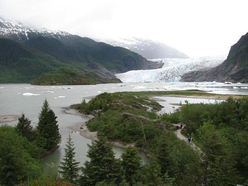 |
| View of Mendenhall Glacier from behind the Visitor's Center |
The East Glacier Trail starts behind the visitors center and starts on the Trail of Times. It's about a 3.5 mile loop trail, with moderate elevation gain. The trail is mostly in the forest, but there are occasional clearings to give you a glimpse of the glacier from higher up. A small waterfall, the AJ waterfall, is also a short walk from the trail.
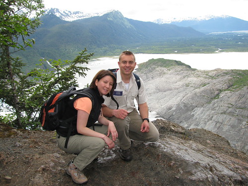
 Once at the top there's a rock outcrop with a fantastic view of the Juneau icefields - definitely worth the hike. From there, you can see people trekking on the icefields. We also saw a few helicopters who touched down on the glacier for about 20 minutes while their passengers walked around a bit. They probably paid few hundred bucks for their tour. Our hike was free. There was also a yellow igloo like structure towards the left hand side of the icefield. That may have been the dog camp where people can go dog sledding as part of a tour.
 The rock outcrop made for a great place to have lunch. It's definitely the best view of the glaciers I've had so far here. Unfortunately, the sky looked a bit ominous and we decided to turn around to avoid rock scrambling in the rain. I think if we kept going a bit further though, we could actually touch the glacier. It's not really wise to go near the face of a glacier since it could break off, but it would be cool to get a bit closer. Perhaps next time. Even as it stands though, this ranks high up there on my favorite hikes in Juneau.
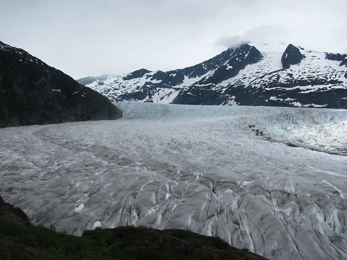 |
| View of Juneau Icefields from the West Glacier Trail |
Sunday, May 15, 2011
Point Bridget State Park


After a little break, we headed up another half mile to Blue Mussel Cabin. Not as many people come all the way to the end, so it was a very peaceful place to be. It was very tempting to just lay down across the picnic table for a nap after the long walk there.

Sunday, April 17, 2011
Windfall Lake Trail
 |
| Windfall Lake - still a bit iced over |
Up to now, I've only done the short trails but I am now eager to do longer ones. Unfortunately I don't have the right equipment to do any 'climbing' in early Spring conditions. Even the low elevation ones can be icy and a bit difficult to traverse. So another easy low elevation trail here is the Windfall Lake Trail.

I was a little disappointed the trail was entirely through the forest. I had hoped for some clearing to get views of the peaks you get a glimpse of towards beginning of the trail. The whole way is shaded though and you don't get a view until you get to the lake... and it's 3.5 miles to the lake from the trailhead. The trail is again planked and icy. It took us an hour longer to do the hike than expected. We saw a family of four coming back from the lake though, with their bicycles. It can't imagine walking that trail with a bike. Or even riding on it. Either they thought it sucked bad too or we are just wusses.
Parts of the trail crosses rivers so there are several foot bridges along the way. It's still icy at parts, and silly Millie fell in as she went on the ice to get closer to water. I think she was a bit shocked too but she managed to swim and make her way towards us at which point we helped her out. Once at the lake, we decided to keep her on the leash since we didn't want her falling through the thin ice over the lake.
 The last little bit of the trail splits into two and one path leads to a cabin maintained by the Forest Service. The other supposedly goes to the lake but there is also lake access at the cabin. It was our first visit to one of these hyped cabins. For $35/night, you can rent one of these through recreation.gov. This one was a pretty nice cabin. There's a bunk in there where about 4 people can probably sleep (must bring own sleeping bags). A table inside and outside, and a propane heater. There's a solar powered outhouse outside the cabin. There's no running water, but there's a canoe you can use to go out on the lake.
We didn't stay the night at the cabin, but it is available as a warming hut for the public during hours of 10-5. We had our lunch on the outside deck and turned around. I suppose it would be very nice though in the summer to just relax out there on the canoe, away from everything.
Sunday, April 10, 2011
Lena Point Trail

The trailhead for this trail was tricky to find. From Egan Drive, turn left towards the Lena Beach picnic area. Maybe about a mile down, there is a sign facing the road (not down or up the road) that says "Lena Point Trail". It's difficult to see ahead of time but you might notice it as you drive by. If you end up at the turnoff to the radio tower or the NOAA building, both which will be on your right, you went too far. There's a big empty parking lot used by the government right next to the trailhead. We parked by the trailhead because we weren't sure parking in the lot was allowed.
The trail is mostly on planks through the woods. Seems a lot of the trails here in Juneau have planks laid down. This makes it a bit tricky because it can get slippery. Or you could fall off it. There is a slight (~230 ft) elevation gain on the trail, and once up top and out the woods, about a mile out, you get a fantastic view from Lena Point overlooking Lena Cove and the sea. There's even a bench up there from which to enjoy the view.
Sunday, April 3, 2011
Boy Scout/Crow Point Trails

To get to the trailhead, turn left from Egan just before the Herbert River and then turn right at the T. It's only about a mile or so away from Egan. The trail starts off in the woods, and there are still icy patches in the early Spring time. I've come to realize that clamp ons or some sort of traction on your boots are really necessary if you want to enjoy some of these trails in Juneau before the summer. Once out of the woods, you come out on the meadow and you see Eagle Beach across the river. A little further down and you hit the beach. There are multiple ways you can get to either Crow Point or the Boy Scout Camp. We went to neither this time around because it was raining. The walk along the beach is really nice though, since there was no one else out there. It sounds like a popular trail though, so I reckon it's a bit more crowded when the weather is nice. The book I have says the trail is a 1.5 miles one way, but it seemed like it was a little longer than that. Bit hard to tell. There's amost no elevation gain so should be doable in the winter if it's groomed.

Subscribe to:
Posts (Atom)