Today's hike to Gastineau Peak was probably the hardest I've done since hiking in Switzerland back in '07. It's also about three times higher than the highest I've done in Juneau. The trail started on Basin Road at an elevation of about 300 ft. The first hour and half of the trail is actually quite boring. It's a steady hike up a muddy trail through the rainforest. If I didn't have Millie with me, I could've avoided it by taking the Mt. Roberts Tram up from downtown to about 1800 ft. That would've made my hike a lot easier. There are couple of view points along the trail to the tram, but none are worth stopping for if you plan to hike past the tram stop.
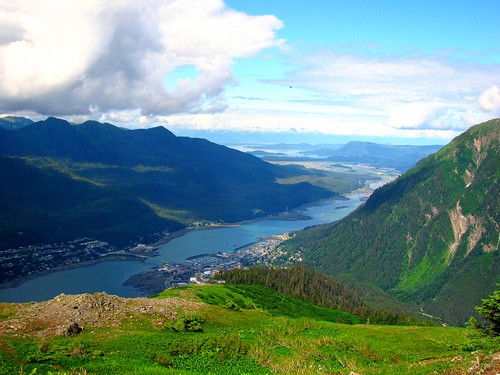
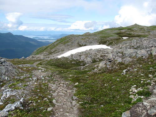
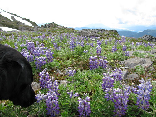 Once at the tram station, I stopped there only to let Millie have a drink at the water bowl they keep out for dogs. The trail below had only a few places for her to get a drink, and it was a pretty warm day out for Juneau. After the brief stop for water and a view, we continued on up the trail. You get a view of Gastineau Channel most of the way up, and the view just gets better and better as you get higher. The terrain also changes from rainforest to sub-alpine, and many wildflowers are in bloom. The trail seems to be a widely used one, by locals and tourists. The few we saw going up that morning were locals. It was comforting knowing others were and will be on the trail since it was just me and Millie today.
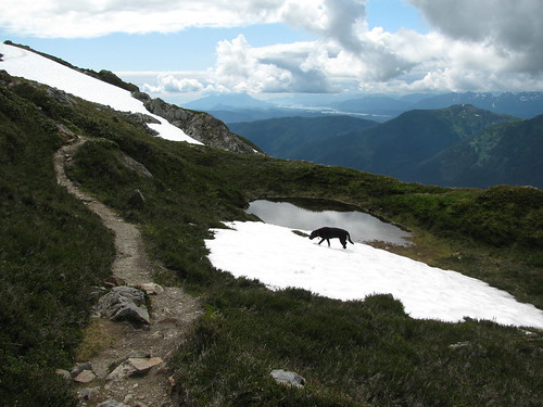 A bit further up the trail we started seeing piles of snow leftover from the winter. Good thing because that was Millie's water source. She would either eat the snow or drink from the stream or puddle made from melting snow. She also liked to roll around in it to cool off.
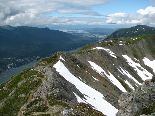
The climb was long and a little difficult since it involved narrow and rocky terrain in places. It wasn't as muddy as the trail below the tram though. There were also walks through thick vegetation and I worried that a bear might be around the corner where I couldn't see. I jingled my bear bell occasionally & luckily I didn't see one. I got to a place that looked like it could be Gastineau Peak, but I was disappointed to find out it was only the Gold Ridge.
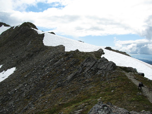 |
| The dreaded ridge |
Once at the peak, which my GPS said was 3672 feet, I had my lunch and got a few snaps. I could see the trail that continues on to the peak of Mount Roberts. It was only supposed to be another mile and 200 feet elevation gain (maybe a bit more in actual since you had to go down first to go up the peak). Perhaps it was another 45 min or so to get there, according to another woman who was on Gastineau Peak with me. I didn't plan on going all the way today, and decided to stick with my plan because I still had to get down and I wasn't sure how I'd fare. I felt fine at the moment, but I figured I'd save that for another time.
 I always take it slow going down. Given the steepness and rockiness of trail in places, I wished I had a stick or poles. It's tough on your knees without them. Then again, it didn't seem to do another hiker much good. On the way down I ran into the guy who had convinced me to go across the dreaded ridge. He had slipped and broken his leg!! There were many other people already there attending to him. They had put a splinter on his leg with his hiking poles, and called the tram station to get a gurney sent up for him. After making sure my help wasn't needed, I kept on heading down. I passed a medic on the way up, followed slowly by 2 not-so-fit looking guys struggling to get a wheeled gurney up top. I wondered to myself how the hell they are going to get that thing up, and then down, but I quietly hoped they were trained and knew what they were doing.
 My legs were getting quite tired and stiff, but there's not much to do but keep going. Another stop for water at the tram and we continued on down the lower half of the mountain. Seemed like such a long way down. It almost feels harder getting down than going up since your legs are tired. It's a shame that going down isn't as enjoyable as going up. Regardless, we made it, and I'm glad to have done it since I had been looking forward to doing for so long. It was a beautiful hike but I doubt I'll be doing that one again this year though. There's plenty other difficult ones to try first. Next year I'll shoot for Mount Roberts.
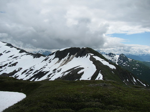 |
| The trail continues on to Mount Roberts |
No comments:
Post a Comment